

DriveTestRoutes
Hornsby Service Centre, New South Wales (NSW) Driving Test Routes
Hornsby Service Centre, New South Wales (NSW) Driving Test Routes
Couldn't load pickup availability
Practice your Hornsby road test route
Real routes used for the Hornsby Service NSW Service Centre at 324 Peats Ferry Road (Pacific Highway), delivered as a Google Maps GPS navigation file with turn-by-turn instructions included. No app, no account, no subscription.
Hornsby Service NSW Service Centre details
Location: 324 Peats Ferry Road (Pacific Highway), Hornsby NSW 2077
Phone: 13 77 88
Hours: Monday to Friday: 8:30am to 5pm. Saturday: 8:30am to 12:30pm. Closed Sunday. Book a driver or rider licence test online through Service NSW or by calling 13 77 88.
Map: View on Google Maps
Street view: Preview the location on Google Street View
Other Service NSW locations near Hornsby
If your appointment ends up at a different nearby location, here's how far each one actually is to drive from this location:
- North Rocks Service NSW service centre: 14.24 km, about 19 minutes
- Ryde Service NSW service centre: 14.47 km, about 23 minutes
- Chatswood Service NSW service centre: 15.64 km, about 23 minutes

This driving test route runs 17.36 km and takes about 42 minutes:
- Drive south, 0.05 km.
- Turn right onto Bridge Road, 0.05 km.
- Turn right onto Peats Ferry Road, 0.60 km.
- Bear right to stay on Peats Ferry Road, 0.16 km.
- Turn left onto Old Berowra Road, 0.65 km.
- Turn right onto Amor Street, 0.15 km.
- Drive east on Amor Street, 0.50 km.
- Enter the roundabout and take the 2nd exit onto Amor Street, 0.24 km.
- Turn left onto Pacific Highway/B83, 0.02 km.
- Make a sharp right onto Baldwin Avenue, 0.10 km.
- Turn left to stay on Baldwin Avenue, 0.12 km.
- Turn right onto Sherbrook Road, 0.74 km.
- Turn right to stay on Sherbrook Road, 0.03 km.
- Turn left to stay on Sherbrook Road, 0.40 km.
- Enter the roundabout and take the 1st exit onto Sherbrook Road, 0.03 km.
- Enter the roundabout and take the 2nd exit onto Sherbrook Road, 0.33 km.
- Enter the roundabout and take the 2nd exit onto Sherbrook Road, 0.58 km.
- Turn left onto Edgeworth David Avenue, 0.51 km.
- Turn left to stay on Edgeworth David Avenue, 0.46 km.
- Turn right onto Woonona Avenue, 0.18 km.
- Drive south on Woonona Avenue, 0.14 km.
- Turn right onto Fern Avenue, 0.12 km.
- Turn right onto Churchill Avenue, 0.33 km.
- Turn left onto Edgeworth David Avenue, 0.33 km.
- Turn right to stay on Edgeworth David Avenue, 1.13 km.
- Turn right onto Pacific Highway/B83. Continue on B83, 0.91 km.
- Bear left onto Bridge Road/B83. Continue on Bridge Road, 0.20 km.
- Turn right onto Peats Ferry Road, 0.60 km.
- Bear right to stay on Peats Ferry Road, 0.16 km.
- Turn left onto Old Berowra Road, 0.45 km.
- Drive north on Old Berowra Road, 0.20 km.
- Turn right onto Amor Street, 0.65 km.
- Enter the roundabout and take the 2nd exit onto Amor Street, 0.24 km.
- Turn left onto Pacific Highway/B83, 0.02 km.
- Make a sharp right onto Baldwin Avenue, 0.10 km.
- Turn left to stay on Baldwin Avenue, 0.12 km.
- Turn right onto Sherbrook Road, 0.31 km.
- Drive south on Sherbrook Road, 0.09 km.
- Turn left onto Salisbury Road, 0.67 km.
- Drive south on Salisbury Road, 0.20 km.
- Turn right onto King Road, 0.32 km.
- Enter the roundabout and take the 1st exit onto Sherbrook Road, 0.31 km.
- Enter Sherbrook Road and take the 1st exit onto Northcote Road, 0.19 km.
- Drive east on Northcote Road, 0.15 km.
- Turn right onto Balmoral Street, 0.31 km.
- Drive south on Balmoral Street, 0.26 km.
- Turn right onto Edgeworth David Avenue, 0.15 km.
- Turn left onto Park Avenue, 0.50 km.
- Turn right onto Alexandria Parade, 0.10 km.
- Drive northwest on Alexandria Parade, 0.30 km.
- Enter the roundabout and take the 2nd exit onto Romsey Street, 0.34 km.
- Turn left onto Edgeworth David Avenue, 0.43 km.
- Turn right onto Pacific Highway/B83, 0.04 km.
- Keep left to take Peats Ferry Road, 0.49 km.
- Drive west on Peats Ferry Road, 0.48 km.
- Turn right onto Bridge Road, 0.05 km.
- Turn left, 0.05 km.
- Your destination is on the left.
This is a sample route only. The full, current set of Hornsby driving test routes is included in the download.
Route breakdown
- Distance: 17.36 km
- Duration: about 42 minutes
- Turns: 44 total, 14 left and 19 right, plus 2 bear rights and 7 roundabouts and 2 bear lefts
- Longest stretch: Edgeworth David Avenue, 3.01 km
What to expect on the roads this route covers
Edgeworth David Avenue dominates this driving test route, a real primary-classed road, and this route touches the Pacific Highway, one of Australia's most well-known named highways, right at the office's own building, alongside Peats Ferry Road, also primary-classed.
Tips for this specific route
- Get comfortable holding speed on Edgeworth David Avenue, a real primary-classed road.
- This route touches the Pacific Highway right at the office's own building, one of Australia's most well-known named highways, worth extra attention.
- Expect a heavily right-leaning turn pattern: 19 of the 33 regular turns on this route are rights, plus two bear-rights, two bear-lefts, and 7 roundabouts, one of the more maneuver-dense routes in this catalog.

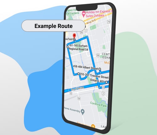
Drive Test Route
Pass Your Driving Test With Confidence!
Up-to-date Driving Test Route maps.
Navigate route on your mobile phone using GPS and practice the route to familiarize yourself with the actual roads of the driving test.
You may also like
-
Yass Service Centre, New South Wales (NSW) Driving Test Routes
Regular price $14.99 AUDRegular priceUnit price per$24.99 AUDSale price $14.99 AUDSale -
Nambucca Heads Service Centre, New South Wales (NSW) Driving Test Routes
Regular price $14.99 AUDRegular priceUnit price per$24.99 AUDSale price $14.99 AUDSale -
Gunnedah Service Centre, New South Wales (NSW) Driving Test Routes
Regular price $14.99 AUDRegular priceUnit price per$24.99 AUDSale price $14.99 AUDSale -
Toukley Service Centre, New South Wales (NSW) Driving Test Routes
Regular price $14.99 AUDRegular priceUnit price per$24.99 AUDSale price $14.99 AUDSale


